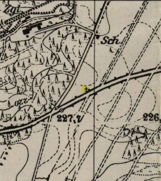
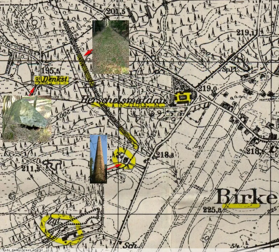
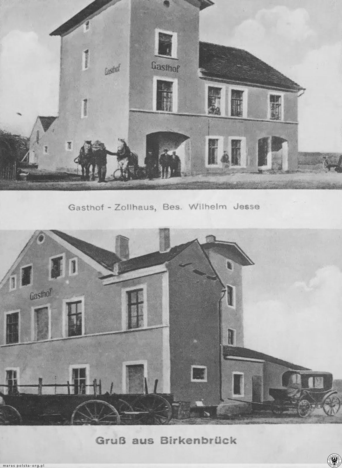
The map shows the Reichsstraße 115 (now DK94), the Zollhaus inn at the crossroads, the Haidehäuser colony to the north, the Grenzhäuser to the east, the shooting range and field, and to the west the Herschelswaldau manor with its brickyard and siding. A concrete sandbag wall from the shooting range can still be seen in the forest after the undergrowth was cleared.
One kilometer west of the village, a camp of the Reichsarbeitsdienst (RAD) - detachment 105/5 operated. In front of it stood a stone with the inscription 'Ehret die Arbeit und achtet den Arbeiter' (Honor work and respect the worker).
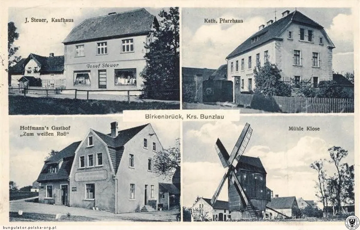
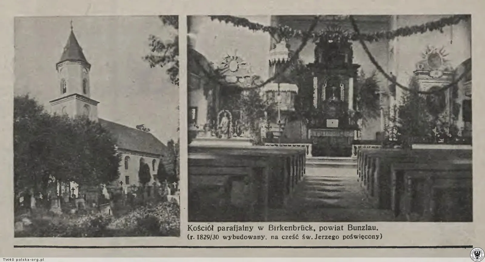
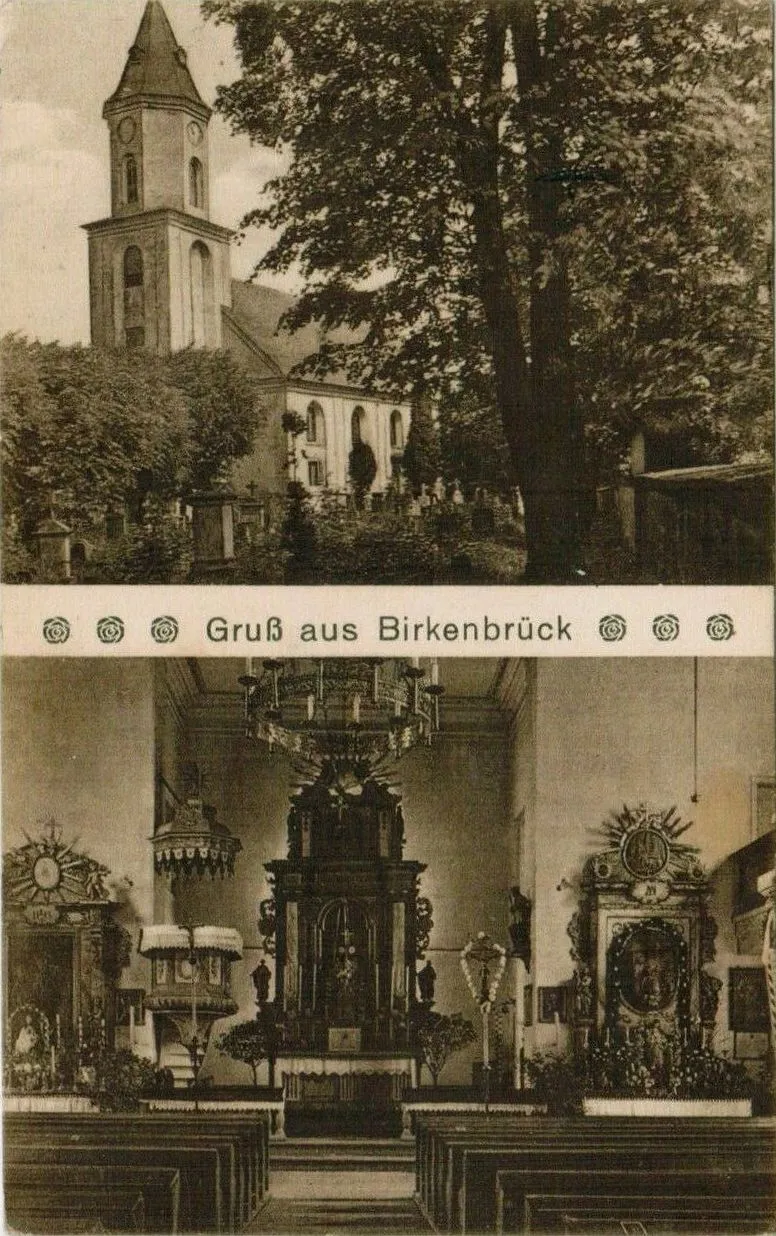
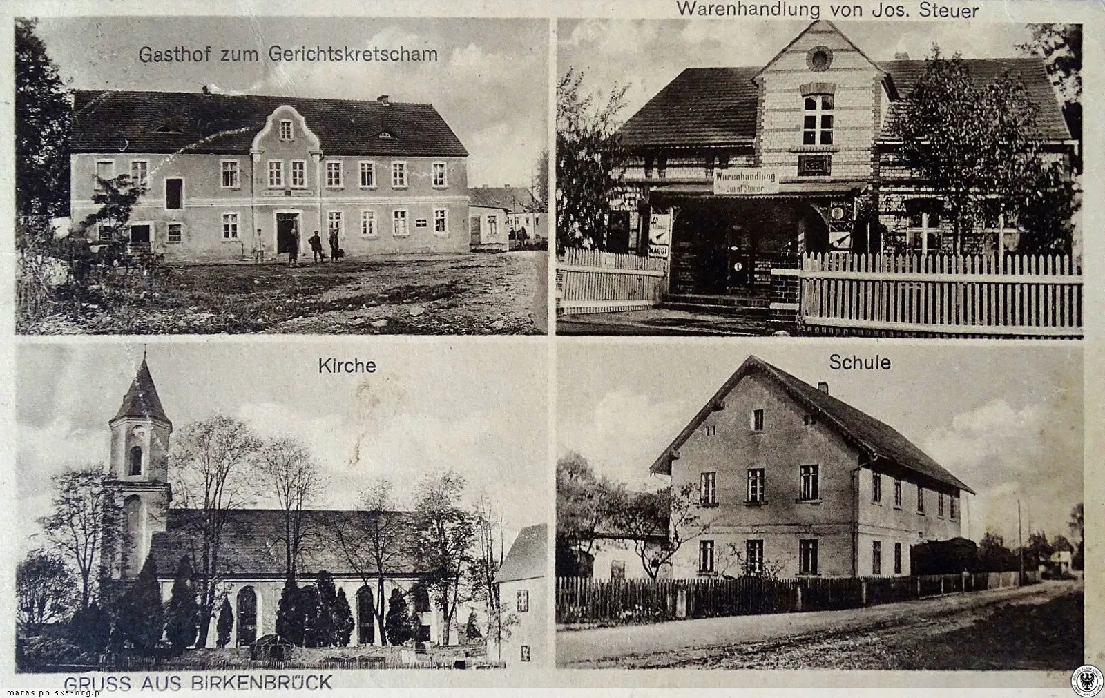
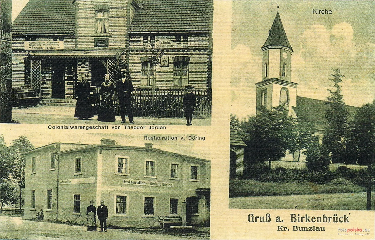
1942 · On the map, in the same place for years. The brickyard...1942 · On the map: the stone (monument), the nasyp (embankment)...1935–1940 · Brzeźnik on a 4-part postcard1934 · Parish church in Brzeźnik.1933 · Brzeźnik - church of the Immaculate Conception of the...
1742 – 1932Under Prussia and the German Empire
8 March 1928
Disaster at the Herschelswaldau mine
In the nearby Herschelswaldau mine, the cable of the lift broke; in two subsequent accidents on that day, a colliery official and a miner were killed, and one person was seriously injured. Herschelswaldau is listed in J. Jaros's register of brown coal mines.
Fritz Faustmann, a teacher from Ocice (Ottendorf), was shot while travelling with his son on a motorcycle through Brzeźnik, 2 km to the west of the village. Teachers from Ocice and Zebrzydowa erected a memorial stone with a cross in his honour.
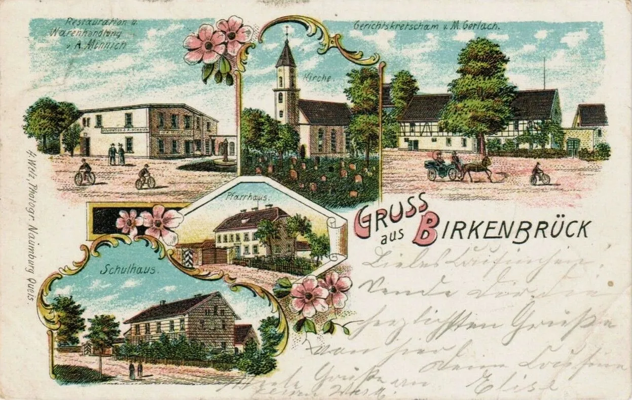
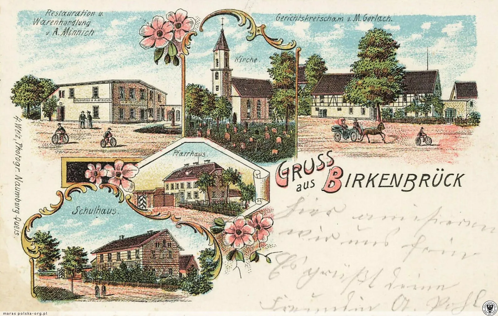
According to Meyer's Gazetteer, Birkenbrück in the Bolesławiec district had 517 inhabitants, a Catholic parish church and its own civil registry office; the Evangelicals belonged to the parish in Ocice. A lithograph postcard from the end of the 19th century shows A. Minnich's restaurant and shop, the church, M. Gerlach's court inn, the parish house and the school.
A map from 1888 shows: the colony Friedrichsheide to the north of the village, a pheasantry (Fasanerie) among the ponds near the Herschelswaldau farm, two brickworks (Zgl.) - one near Herschelswaldau and one near the Rimpelsberg colony - and the Zollhaus inn and Grenzhäuser.
The Birkenbrück administrative district was established
The Birkenbrück administrative district No. 2 was established from the municipalities of Birkenbrück and Herrmannsdorf (Kierżno). The first head of the district was the landowner Herrmann Perlitz from Herrmannsdorf.
The address book of estates lists: Herrmannsdorf/Herschelswaldau – 1149 morgen (770 arable, 327 woodland), owner Gustav Friedrich Herrmann Porlitz (Perlitz); in Birkenbrück, the largest peasant holding – 610 morgen – was that of the bailiff Laurentz Ignatz Hasse.
In the decade before 1861, 43 farms and peasant plots were sold in Birkenbrück – one of the highest numbers in the district (only Gießmannsdorf/Goszyce had more).
In the 1840s, the miller Herschel from Paritz/Parzyce built a manor named after him, Herschelswaldau. It was formally part of Herrmannsdorf/Kierżno, but it lay just to the west of the edge of Birkenbrück.
In 1838-1840, the parish priest from Birkenbrück, Franz Kretschmer, was the archpriest of the Naumburg/Nowogrodziec district, to which the parish belonged.
New church: In 1828, the old, dilapidated church was demolished. In 1829–1832, the present-day Catholic church with a distant tower was built, consecrated in 1832 (the Polish source SGTS incorrectly calls it an evangelical temple).
Recollection of a travelling stocking-weaver: he walked along the old military road (Heerstraße) through Naumburg, Thiergarten and Birkenbrück in deep snow and stopped at the Jagdschänke inn.
According to the gmina's film (2017), a small skirmish took place between Napoleonic troops and Russian and Prussian troops near the current railway tracks, and a small monument still stands near the battlefield today. We have not yet found another source - if you know where the monument is, please let us know.
At the time of the secularisation of the Magdalene convent in Nowogrodziec, Birkenbrück belonged to its estates (along with, among others, Kierżno – Herrmannsdorf – and Parzyce). The estates were taken over by the Prussian state as royal domains.
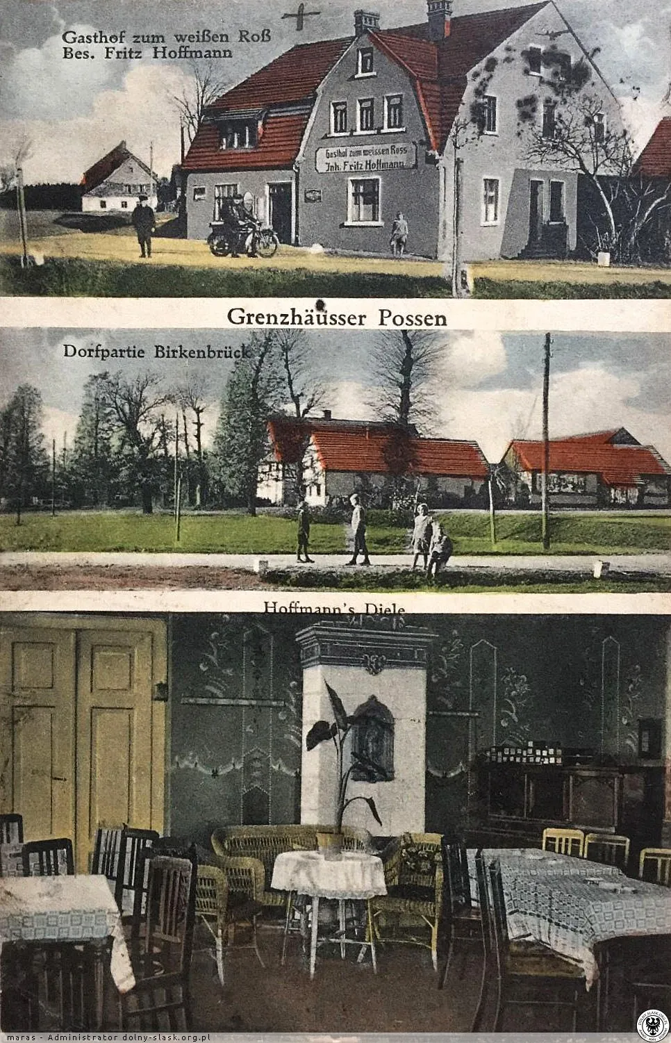
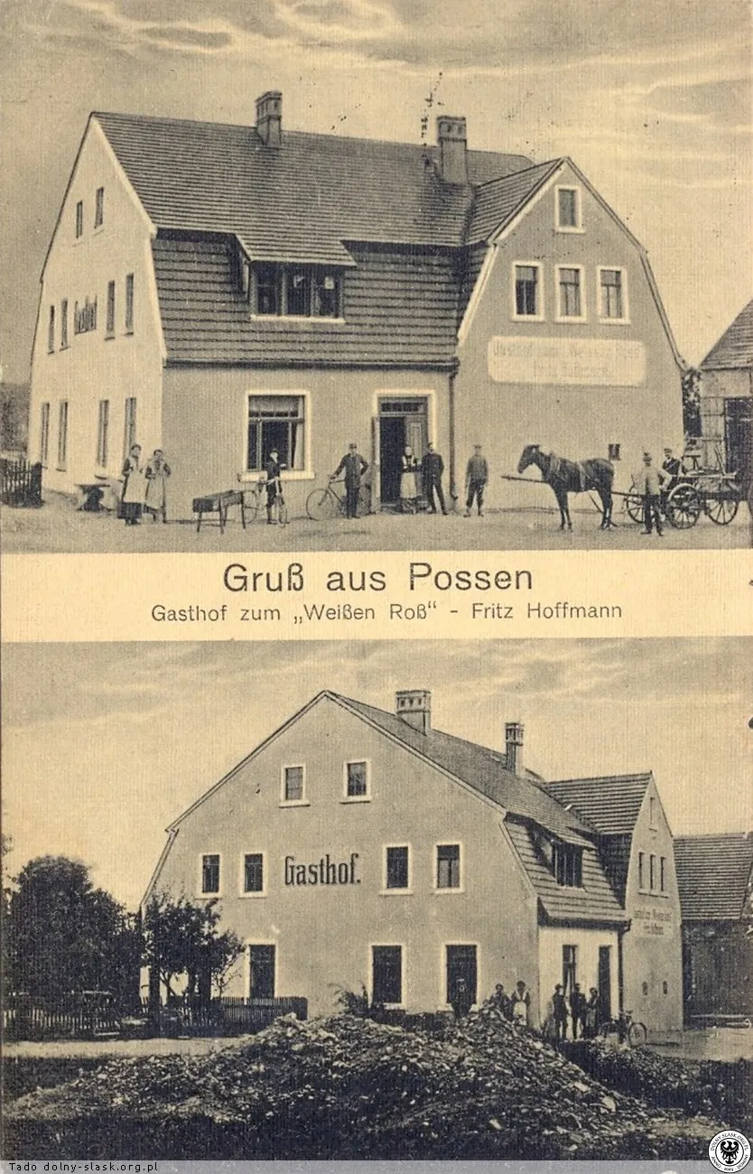
Old building on the edge of Mierzwin, the inn Zum weißen Ross of Fritz Hoffmann and a fragment of the village.
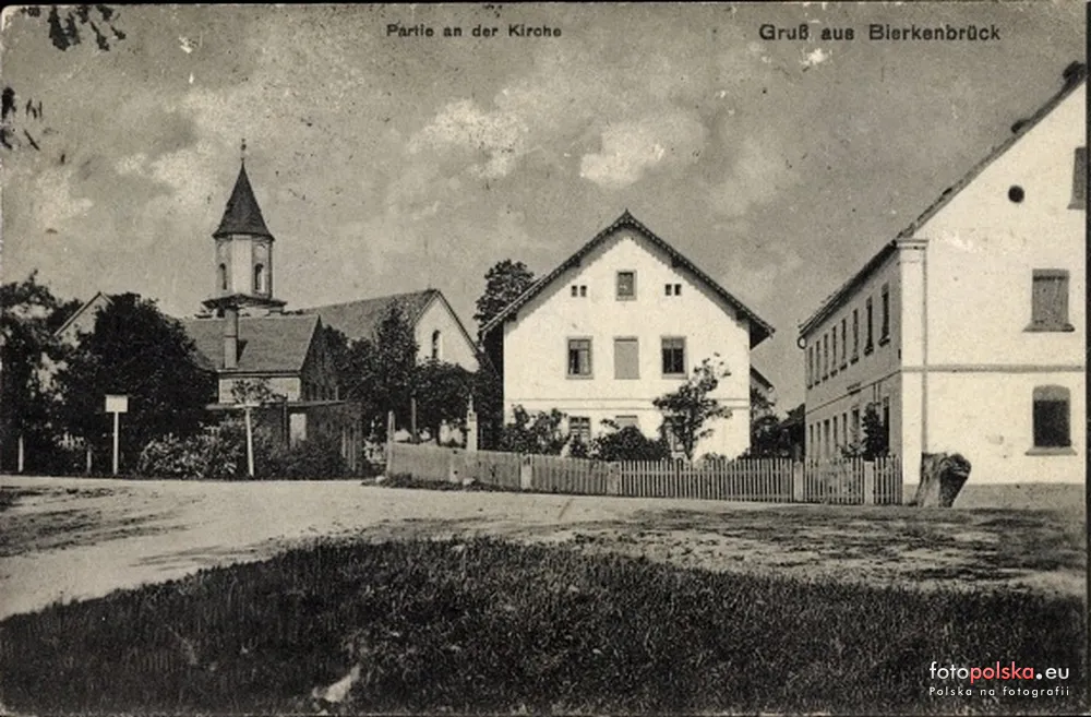
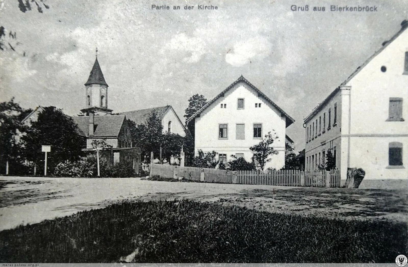
1930–1936 · Area around the church.1930–1945 · Inn Zum weißen Ross.1925–1930 · Gospoda Pod Białym Rumakiem.1925–1930 · Brzeźnik. Wilhelm Jesse's Inn (Gasthof Zollhaus).1925–1930 · Brzeźnik. Court tavern, shop, church and school.1920–1922 · Brzeźnik, fragment with the church.1920–1930 · Postcard from Brzeźnik.1900–1906 · Brzeźnik.1895–1900 · Brzeźnik on a lithograph postcard from the late 19th...