23 November 2024
RAD camp stone returns to its original location
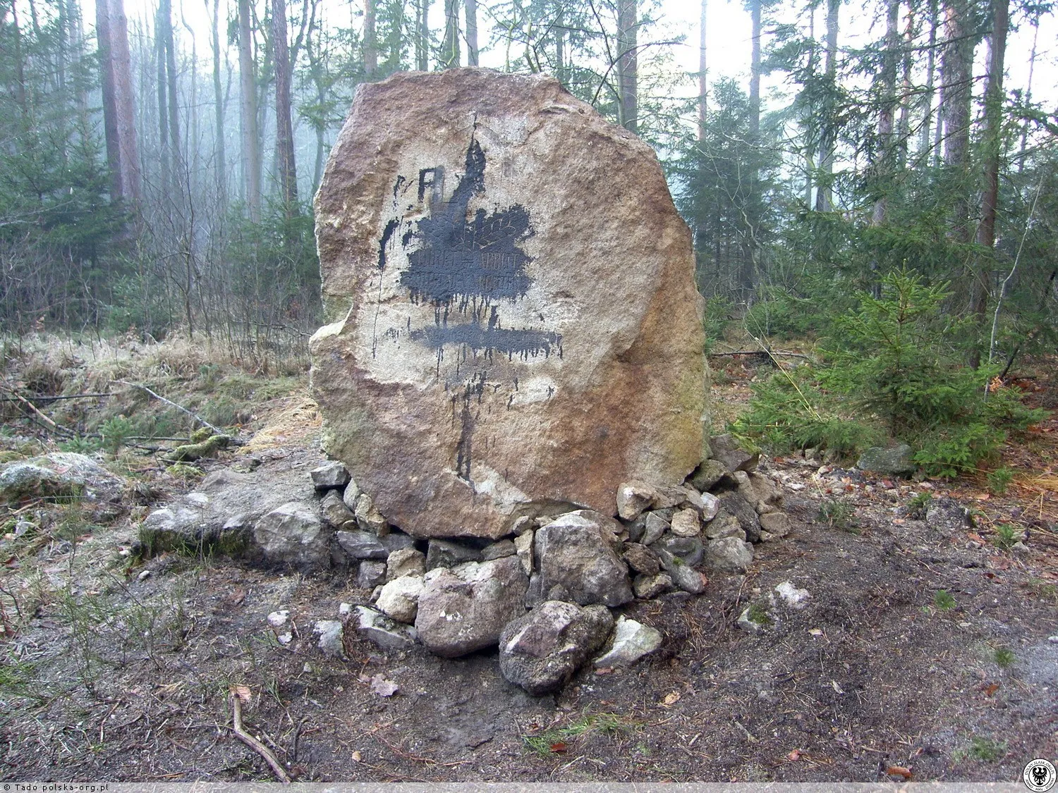
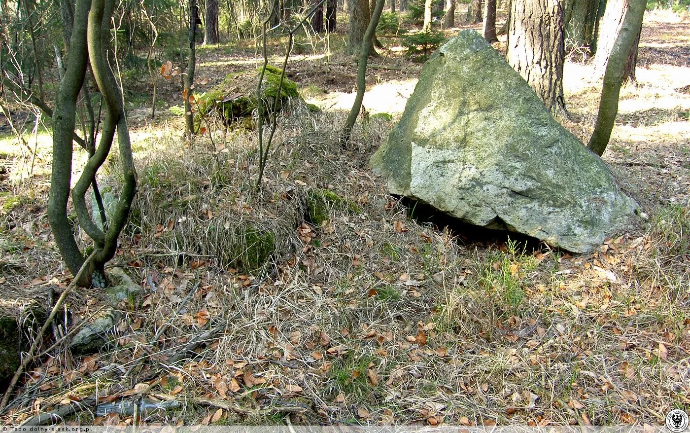
The Historical Circle from Bolesławiec has re-erected a quartzite boulder from in front of the former Reich Labour Service camp, which lay face down in the forest after 1945.
 BrzeźnikBirkenbrück
Brzeźnik / History
The history of Brzeźnik from today backwards — to the medieval founding of the village and the Lusatian culture settlement.
The Historical Circle from Bolesławiec has re-erected a quartzite boulder from in front of the former Reich Labour Service camp, which lay face down in the forest after 1945.
According to the National Census 2021, 884 people live in the village (49.8% women). The village is approximately 1.8 km long and is located on National Road No. 94, in the Izera Foothills, at an altitude of 205-220 m.
Around 890 inhabitants. A fire station and a shop are located near the church, and in the former restaurant building there is a library and a community center; to the north, an LZS sports complex with a shelter and changing rooms. The Women's Agricultural Association, the sports club 'Talent', and a school-pre-school complex operate.
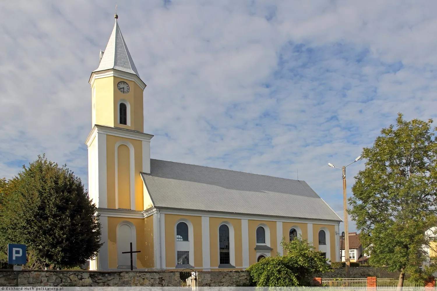
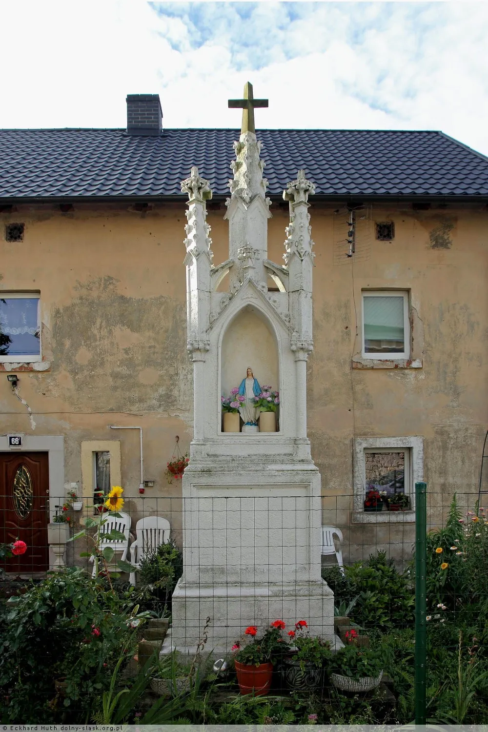
Residents restored the pre-war stone cross using donations. A plaque on the pedestal reads in Polish and German: 'Lord, forgive us our sins and grant us peace.' Brzeźnik is considered the village richest in roadside chapels in the diocese.
The school's website states that in 2007, the village had 710 inhabitants, mainly descendants of returnees from Yugoslavia.
Since 2003, a mining plant of the ARSYL company has been operating here with mining areas 'Brzeźnik-Barbara' and 'Brzeźnik-Jan'.

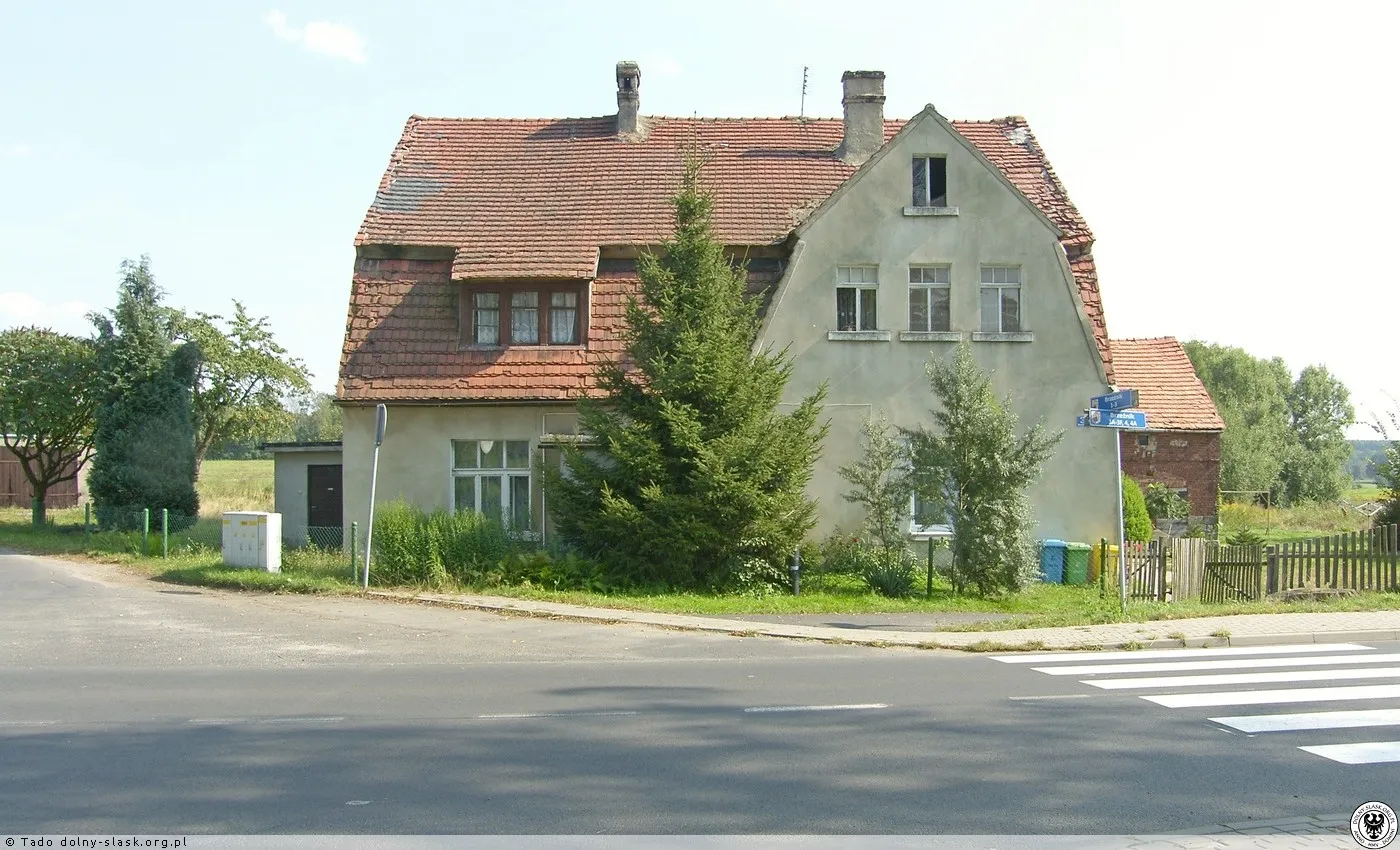
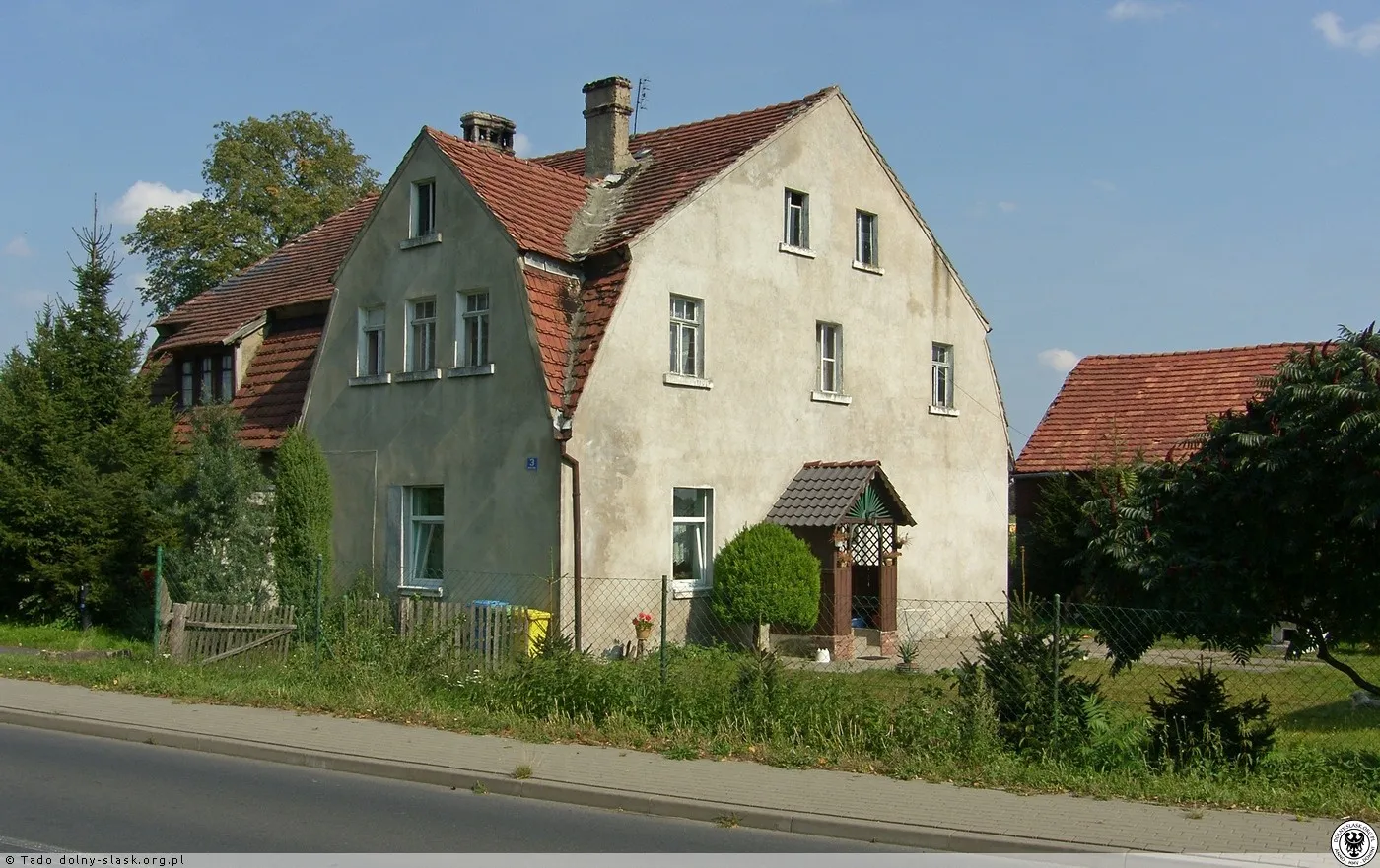
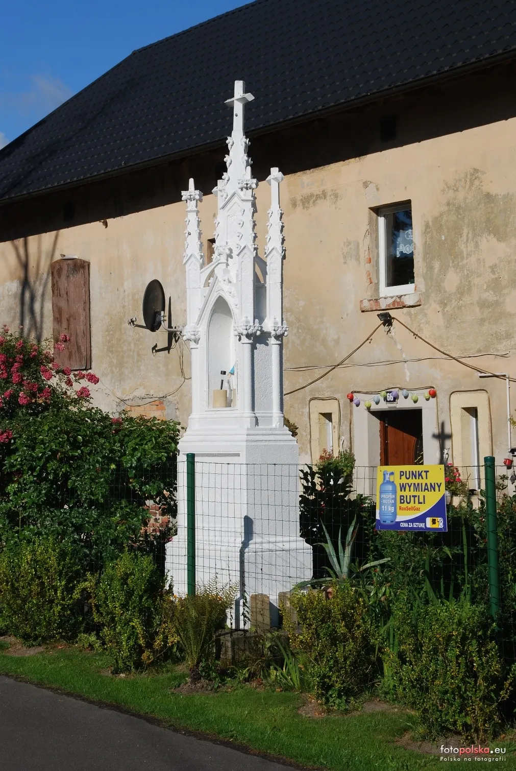
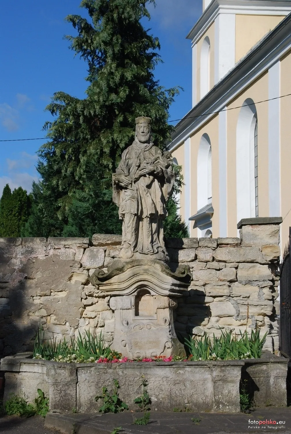
Brzeźnik i Mierzwin wyłączono z parafii MB Różańcowej w Bolesławcu; powstał ośrodek pw. Matki Bożej Nieustającej Pomocy, pierwszym administratorem został ks. Piotr Kudokas.
Arkusz M-33-32-A-a „Bolesławiec” mapy Sztabu Generalnego ZSRR w skali 1:25 000 (wyd. 1984) obejmuje wschodnią część okolic wsi; mapy tej serii były tajne.
Between 1975 and 1998, the village administratively belonged to the Jelenia Góra Voivodeship.
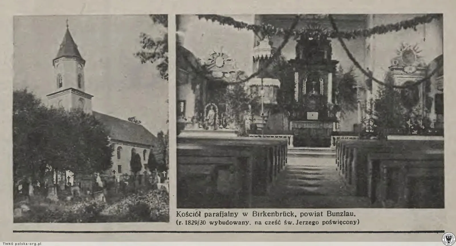
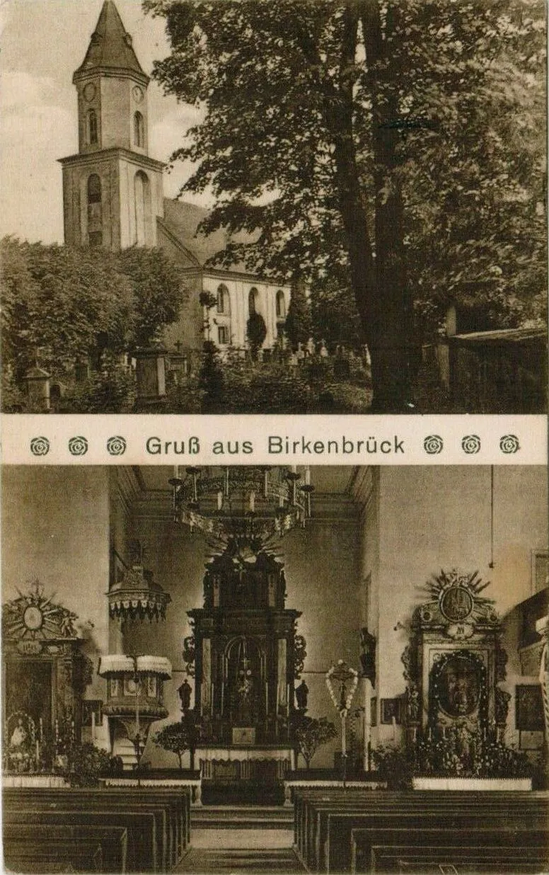
Between 1967 and 1972, the church was renovated, now under the patronage of the Blessed Mother of Perpetual Help.
The US Army Map Service issued the AMS M841 'Siegersdorf' sheet 1:25,000 – a reprint of the German map with names from before 1945, used during the Cold War.
Settlers' memories describe the Women's Agricultural Association, the community center, Brzeźnik Primary School, and the Volunteer Fire Brigade – one of its founders was Józef Sondaj (1940–2011), who served in it for 50 years.
Brzeźnik was largely settled by Poles from Bosnia (former Yugoslavia). They arrived by train at the station in Zebrzydowa and were given German farms - including houses No. 22 and 57. One family lived with the German owner of the house for half a year; in another house, the Russians set up a stable in the guest room. The children attended school in Brzeźnik, often going barefoot in the first few months.
After World War II, the village came under Polish sovereignty. German inhabitants were expelled (1945–1947), and Polish settlers arrived, who, as the local parish priest emphasizes, took care of the kapliczki (chapel-like shrines) left behind.
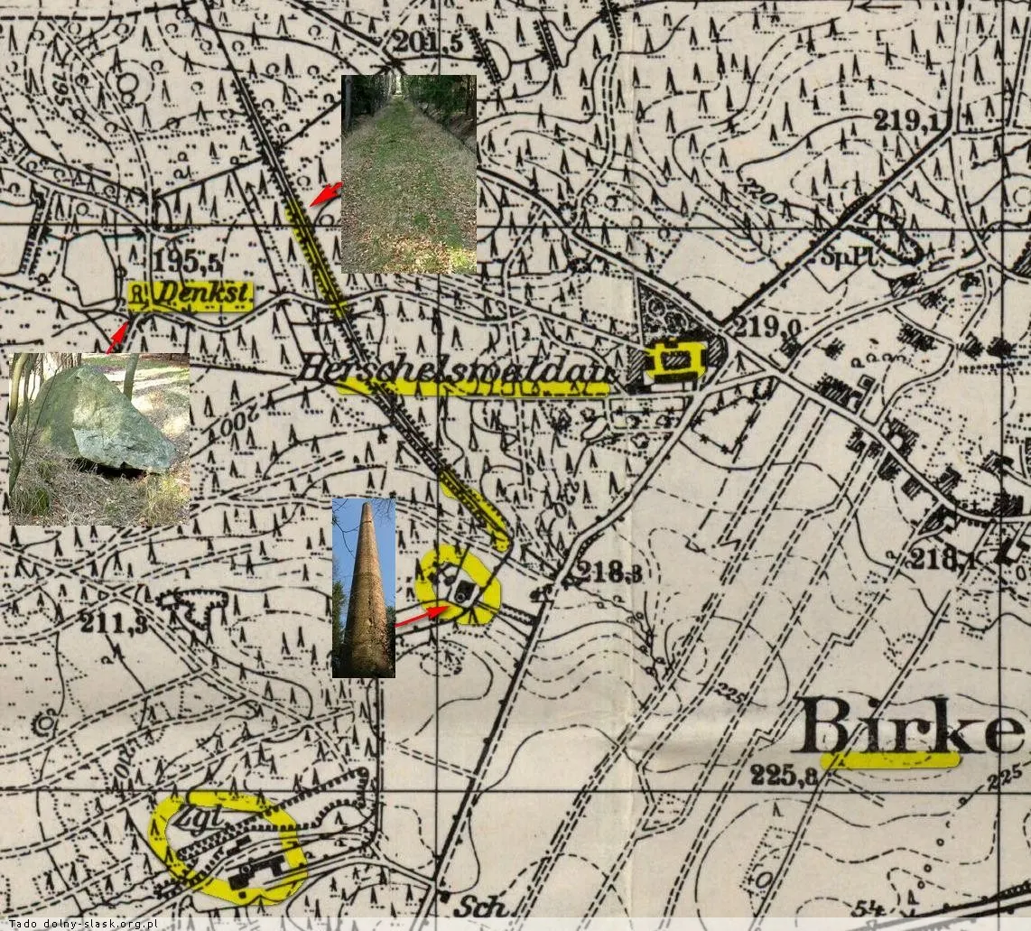
During the Lower Silesian Operation, the Germans established an ad hoc defensive line along Brzeźnik-Kierżno. On the night of 12 February, Soviet infantry with tanks attacked, and by the evening of 13 February, Soviet armored units were already near Nowogrodziec. The fighting destroyed the Herschelswaldau manor and two brickworks; trenches and ditches in the forests can still be seen today (account from TV Łużyce film, 2017).
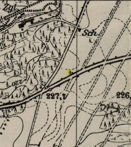
The map shows the Reichsstraße 115 (now DK94), the Zollhaus inn at the crossroads, the Haidehäuser colony to the north, the Grenzhäuser to the east, the shooting range and field, and to the west the Herschelswaldau manor with its brickyard and siding. A concrete sandbag wall from the shooting range can still be seen in the forest after the undergrowth was cleared.
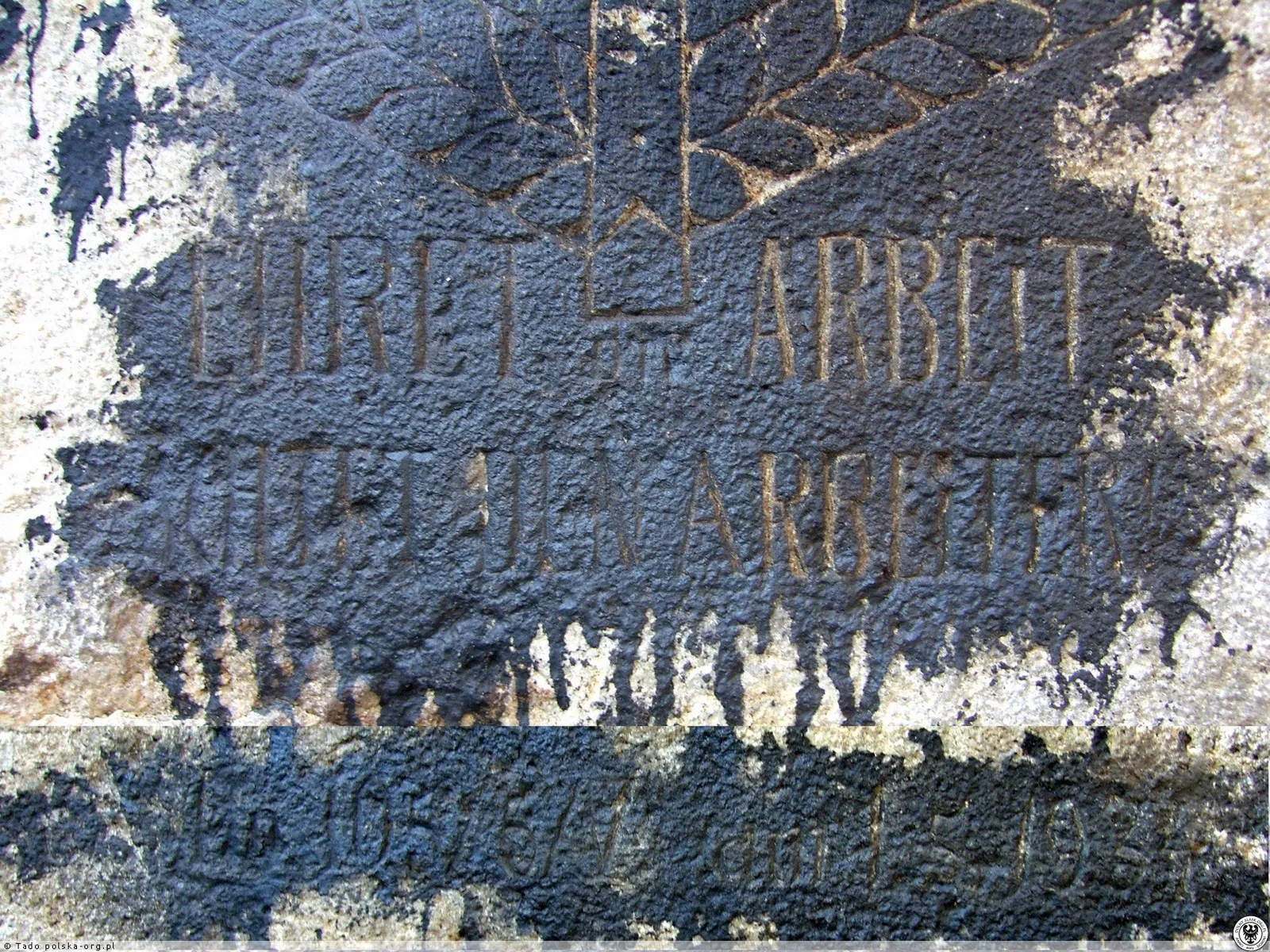
One kilometer west of the village, a camp of the Reichsarbeitsdienst (RAD) - detachment 105/5 operated. In front of it stood a stone with the inscription 'Ehret die Arbeit und achtet den Arbeiter' (Honor work and respect the worker).
In the nearby Herschelswaldau mine, the cable of the lift broke; in two subsequent accidents on that day, a colliery official and a miner were killed, and one person was seriously injured. Herschelswaldau is listed in J. Jaros's register of brown coal mines.
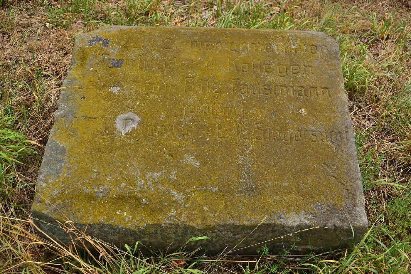
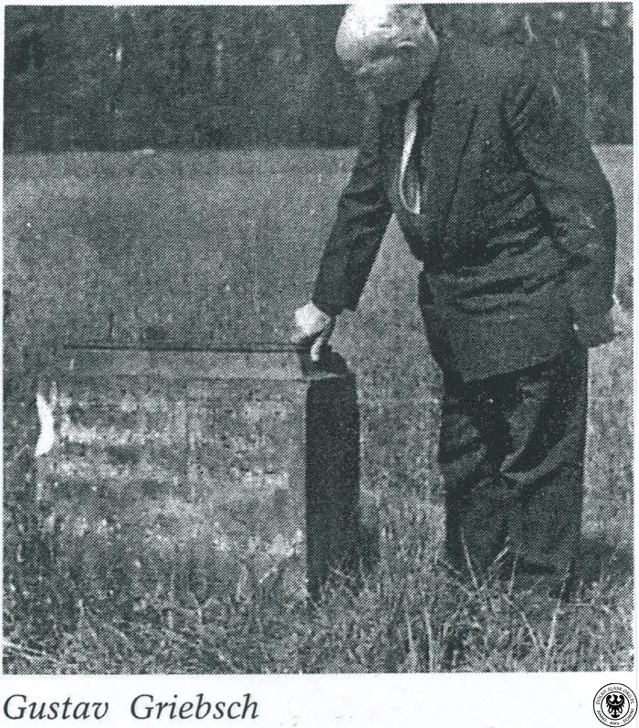
Fritz Faustmann, a teacher from Ocice (Ottendorf), was shot while travelling with his son on a motorcycle through Brzeźnik, 2 km to the west of the village. Teachers from Ocice and Zebrzydowa erected a memorial stone with a cross in his honour.
318 silver coins were discovered during the construction of a new house by carpenter Johann Weiner; the find was donated to the museum in Bolesławiec.
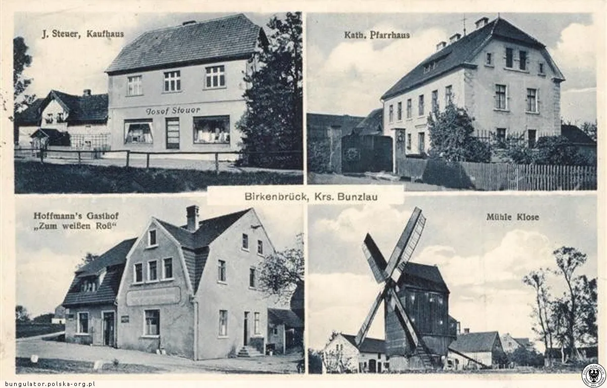
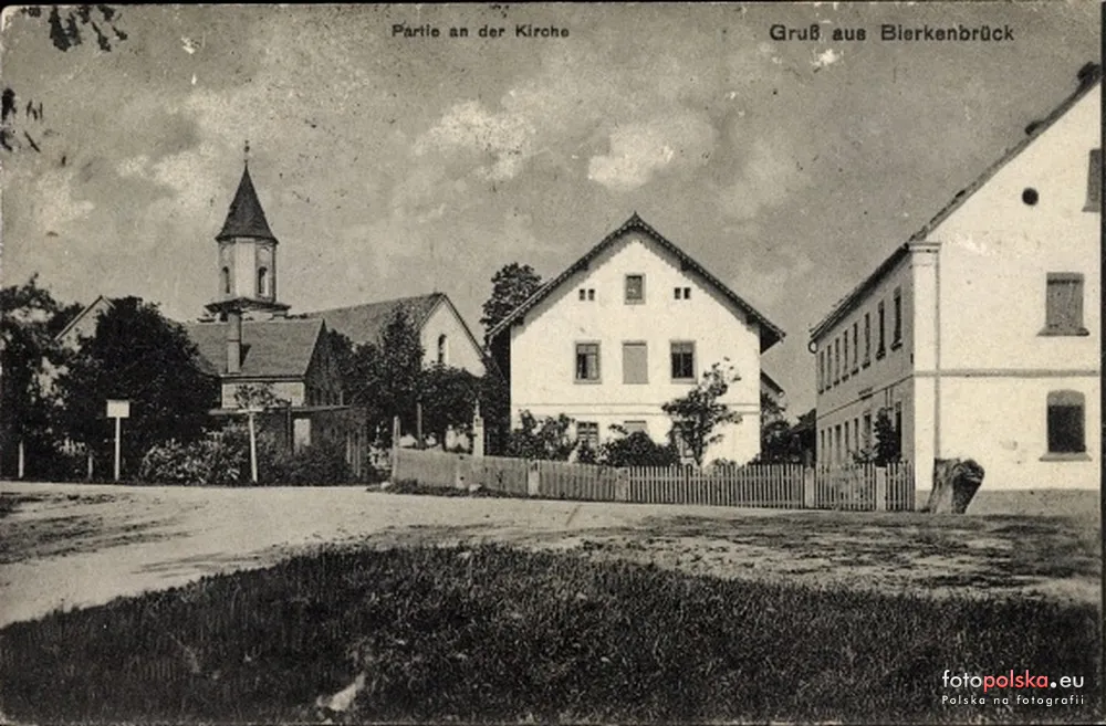
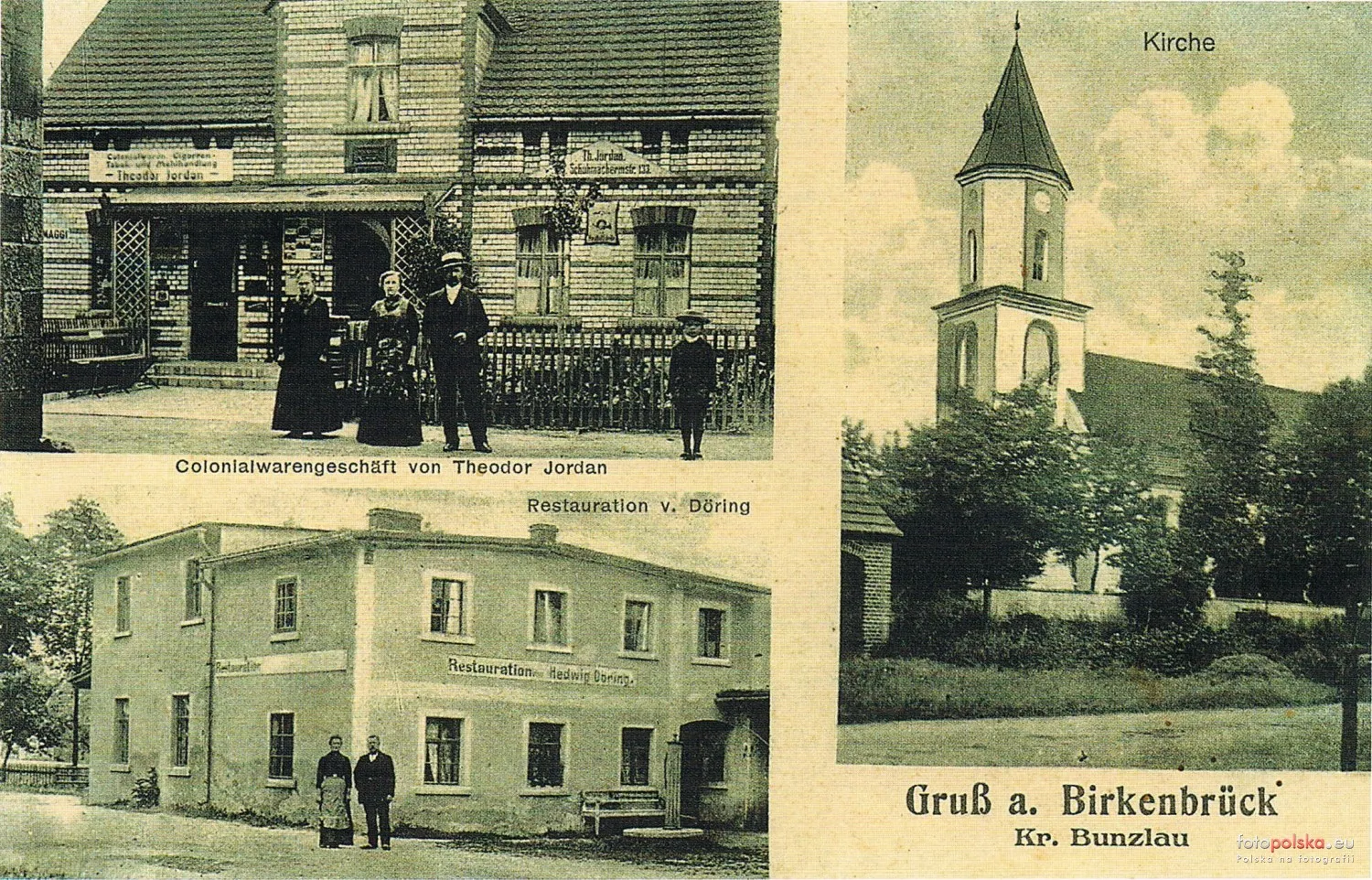
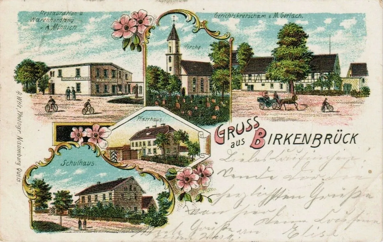
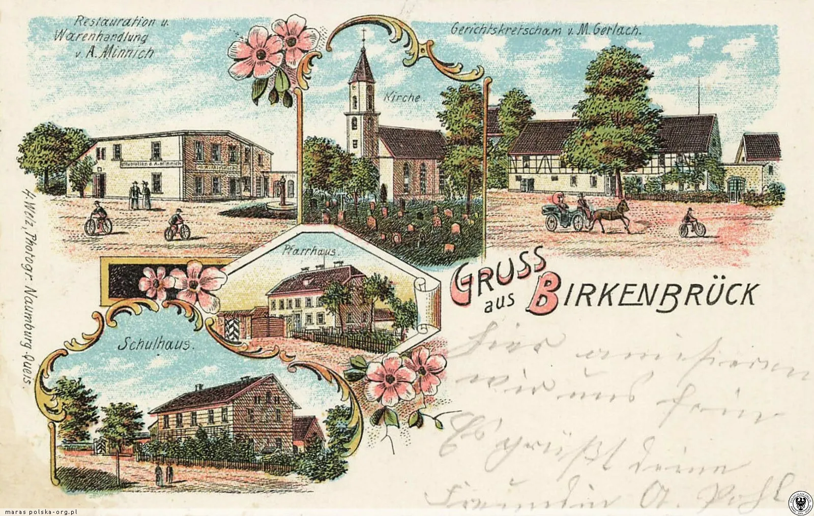
According to Meyer's Gazetteer, Birkenbrück in the Bolesławiec district had 517 inhabitants, a Catholic parish church and its own civil registry office; the Evangelicals belonged to the parish in Ocice. A lithograph postcard from the end of the 19th century shows A. Minnich's restaurant and shop, the church, M. Gerlach's court inn, the parish house and the school.
Neumann's directory: Birkenbrück, village in Bolesławiec district, 571 inhabitants, Catholic parish church, post office in Bolesławiec.
A map from 1888 shows: the colony Friedrichsheide to the north of the village, a pheasantry (Fasanerie) among the ponds near the Herschelswaldau farm, two brickworks (Zgl.) - one near Herschelswaldau and one near the Rimpelsberg colony - and the Zollhaus inn and Grenzhäuser.
Parish priest Eduard Preuß, in the parish since 1840, celebrated his 50th anniversary of ordination.
The Birkenbrück administrative district No. 2 was established from the municipalities of Birkenbrück and Herrmannsdorf (Kierżno). The first head of the district was the landowner Herrmann Perlitz from Herrmannsdorf.
The address book of estates lists: Herrmannsdorf/Herschelswaldau – 1149 morgen (770 arable, 327 woodland), owner Gustav Friedrich Herrmann Porlitz (Perlitz); in Birkenbrück, the largest peasant holding – 610 morgen – was that of the bailiff Laurentz Ignatz Hasse.
In the decade before 1861, 43 farms and peasant plots were sold in Birkenbrück – one of the highest numbers in the district (only Gießmannsdorf/Goszyce had more).
In the 1840s, the miller Herschel from Paritz/Parzyce built a manor named after him, Herschelswaldau. It was formally part of Herrmannsdorf/Kierżno, but it lay just to the west of the edge of Birkenbrück.
In 1838-1840, the parish priest from Birkenbrück, Franz Kretschmer, was the archpriest of the Naumburg/Nowogrodziec district, to which the parish belonged.
6 January 1827
Secularisation of the convent – end of 545 years
According to the gmina's film (2017), a small skirmish took place between Napoleonic troops and Russian and Prussian troops near the current railway tracks, and a small monument still stands near the battlefield today. We have not yet found another source - if you know where the monument is, please let us know.
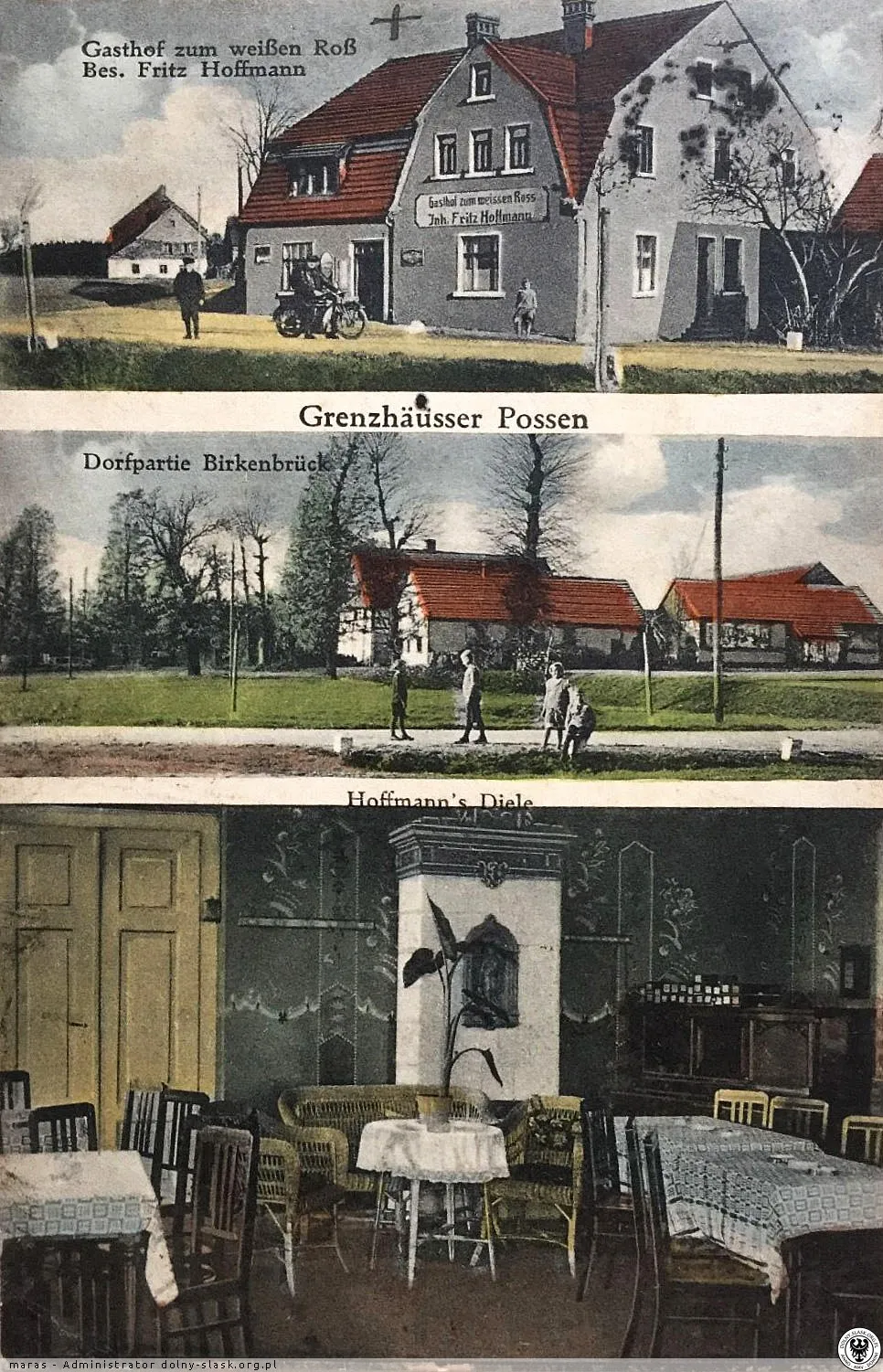
Old building on the edge of Mierzwin, the inn Zum weißen Ross of Fritz Hoffmann and a fragment of the village.
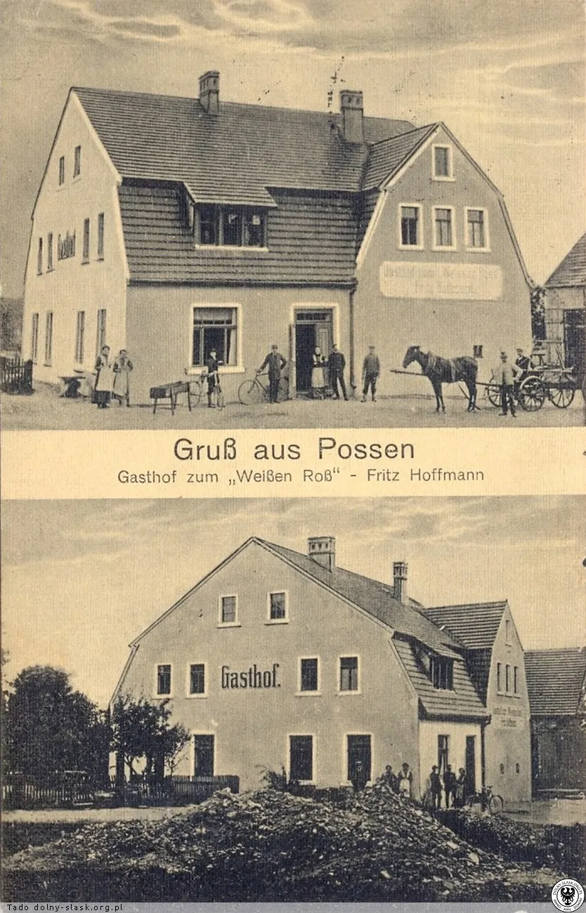
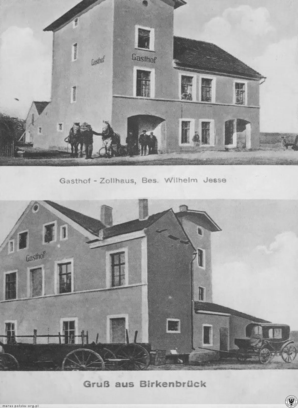
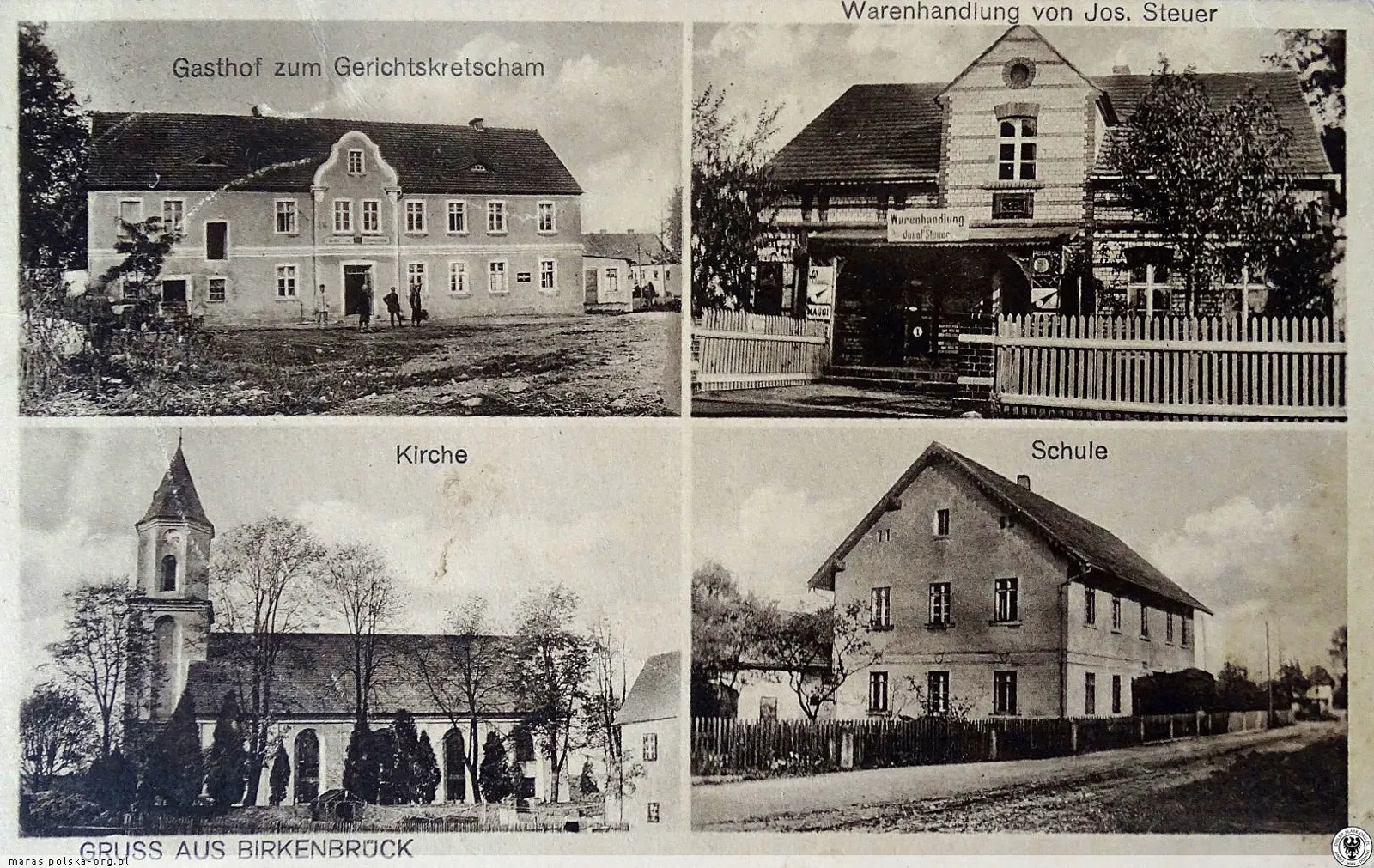
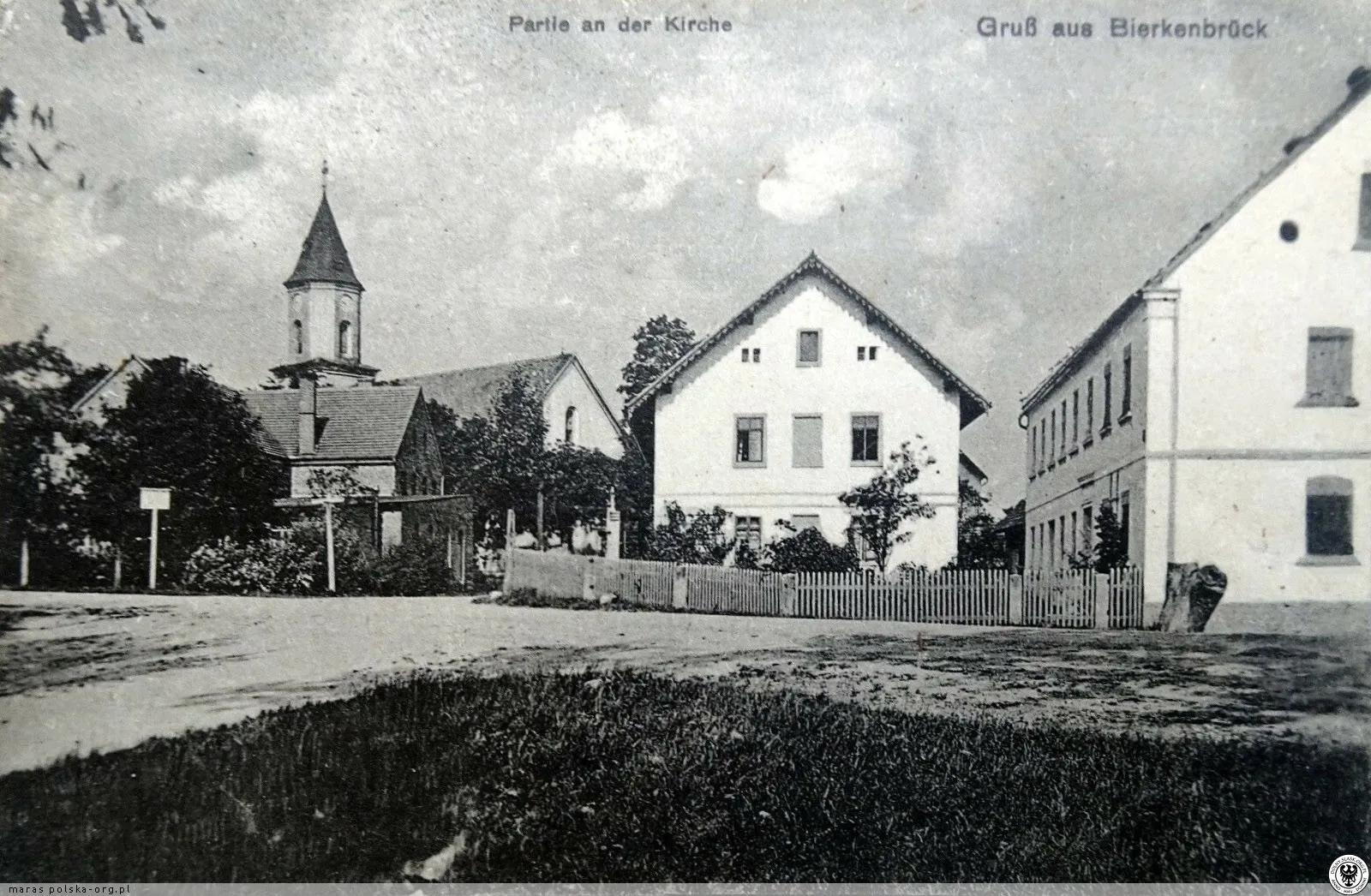
Catholic inhabitants of Kliczków (Klitschdorf) belonged to the parish of Birkenbrück as its branch – baptism records from 1735–1764 have been preserved.
The abbess of the convent in Nowogrodziec, Maria Dorothea Rimpler, established a colony on the lands of Birkenbrück, named after her Rimpelsberg.
Catholic parish records of Birkenbrück have survived (on microfilm) since 1708.
Between 1639 and 1663, during and after the Thirty Years' War, no Catholic services were held in Birkenbrück.
A new church was built in 1614 on the site of a 14th-century temple. The parish was then administered by Martin Augsten, a monk from the Cistercian Abbey in Lubiąż.
Michael Müller, church writer and teacher - the oldest reference to a school in Birkenbrück.
In the list of parish priests, under 1577 there is a mention of Fr Merten.
Bolesławiec measures its 'mile' with chains – on 8 and 10 March from the town moat to Birkenbrück.
Near the village, a band of knight-robbers robbed the wagons with valuables belonging to the Polish king Sigismund I.
Lorenz Bleul (Blewel), sołtys of Birkenbrück, sits as a juror in the royal court of Bolesławiec in a case concerning the Bolesławiec school.
A document of Cardinal John of St. Mark mentions 'plebanus ecclesie in Birkinbruk' – the oldest reference to a clergyman of the parish.
Wieś wymieniona wśród miejscowości płacących dziesięcinę na stół biskupi.
19 czerwca 1265 r. książę Konrad głogowski poświadczył, że klasztor magdalenek w Nowogrodźcu kupił wieś „Berginbrucke” od jego sługi Hermanna zwanego Kul za 46 grzywien czystego srebra. Wieś należała do klasztoru aż do 1810 r., a ich wpływ tłumaczy niezwykłą liczbę przydrożnych kapliczek.
Według przywileju lokacyjnego Nowogrodźca z 1233 r. miasto otrzymało sądownictwo wyższe nad okolicznymi wsiami, wśród nich Birkenbrück. Wieś należy więc do osad założonych przed najazdem mongolskim (1241).
Wieś założono około 1228 r. Niemiecka nazwa Birkenbrück znaczy „brzozowy most”. Brzeźnik należał do grupy dóbr podległych sądom miasta Naumburg (Nowogrodziec) na mocy jego przywileju lokacyjnego.
Od XIV do V w. p.n.e. okolice zamieszkiwała ludność kultury łużyckiej – zachowały się ślady osad i cmentarzysk.
Help build the archive
Help preserve the memory of Brzeźnik. Every postcard, document or family story can be a valuable piece of the village's history.