
A walk through places where the village's history can be seen — from the old inn at the crossroads, past the church and school, to the ruins of the manor farm, the brickworks and the memorial stones in the forest. Where we have both an old and a new photo, drag the slider to compare then and now.
-
1
Zollhaus inn
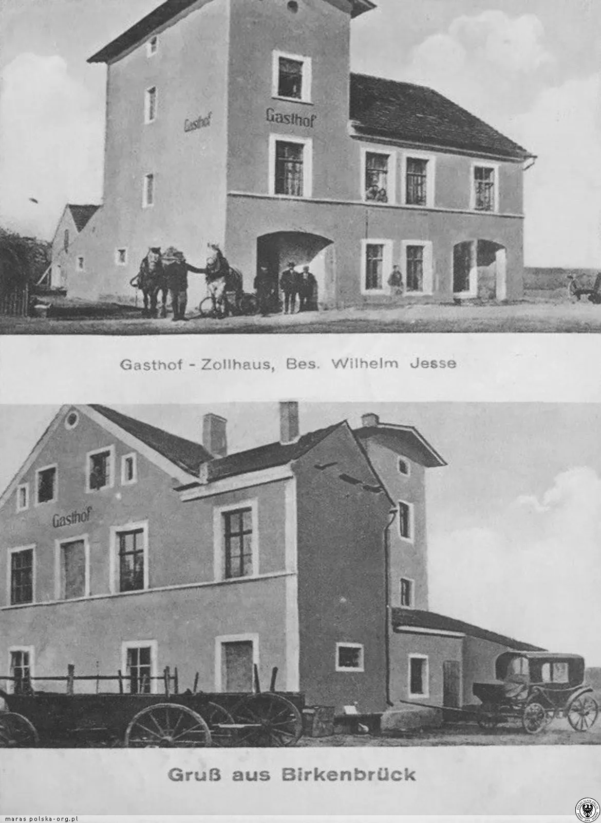
then · 1925 · polska-org.pl — have a photo of this place today? At the old crossroads with the road to Bunzlau - today's junction of the roads to Löwenberg and Naumburg, next to the petrol station - there used to be a Zollhaus (literally 'customs house'), an inn, which from 1925 to 1930 was run by Wilhelm Jesse. It survived until the end of the war.
-
2
The White Horse Inn (house no. 3)
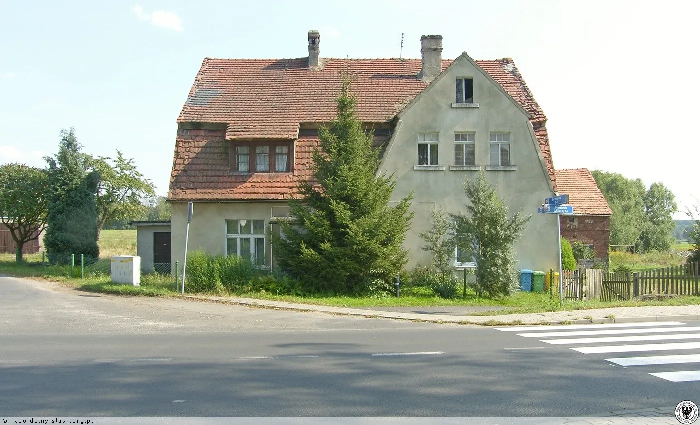 19252016
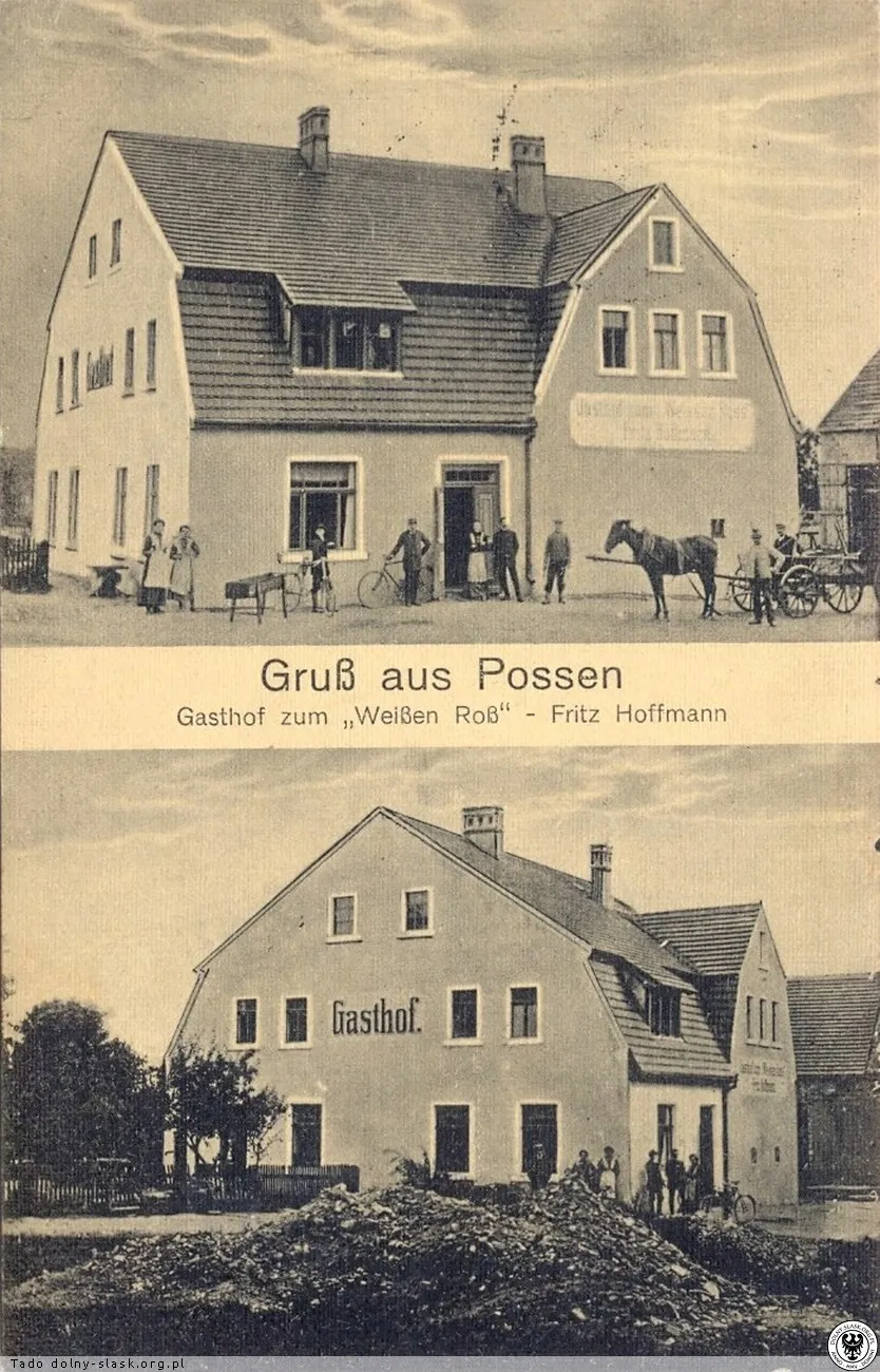
then: 1925 · polska-org.pl · now: 2016 · polska-org.pl
Buildings on the border with Mierzwin (Grenzhäuser): before the war, the inn 'Zum weissen Ross' of Fritz Hoffmann. The building still stands today.
-
3
Church - formerly St. George's
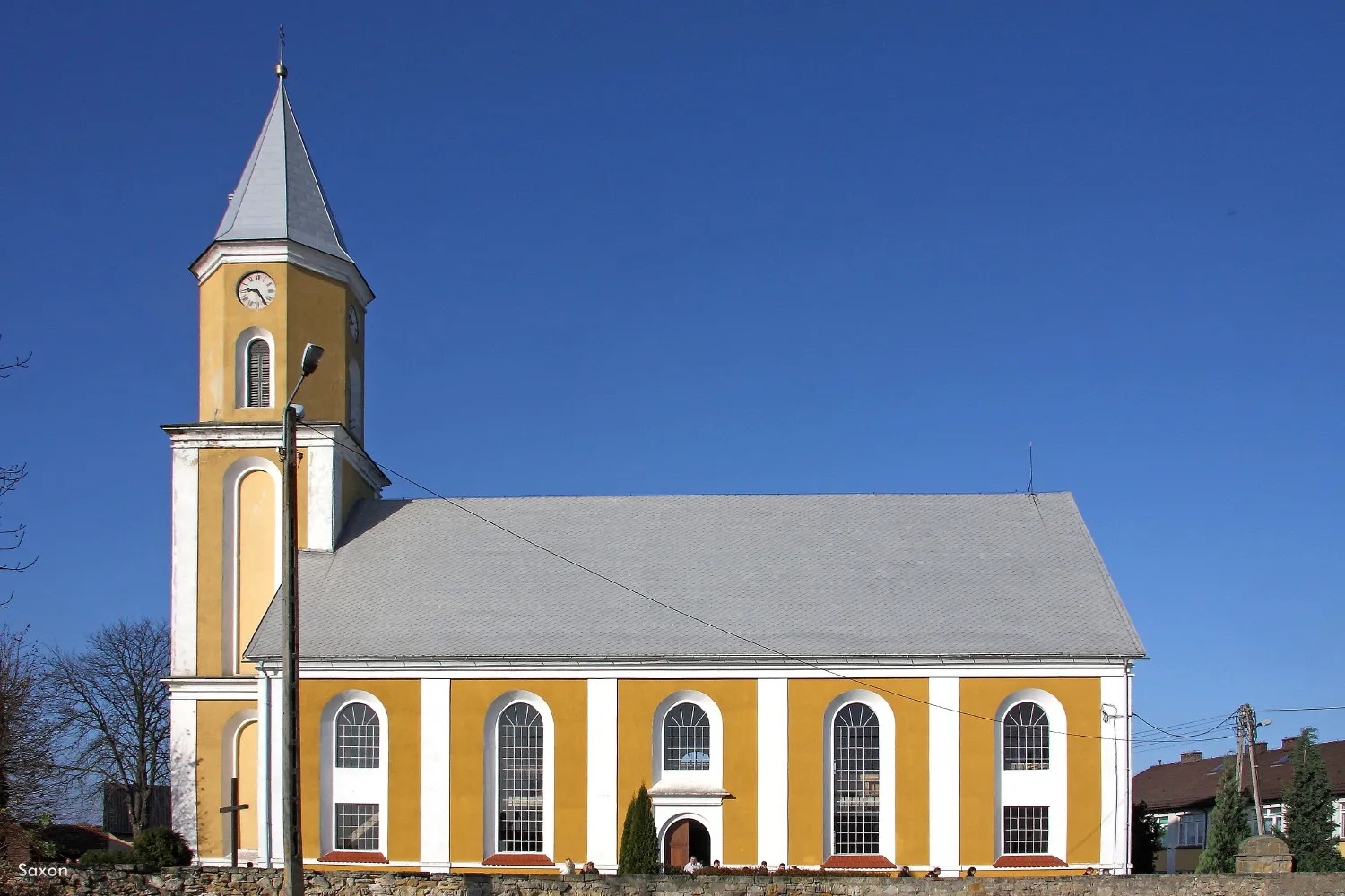 19302012
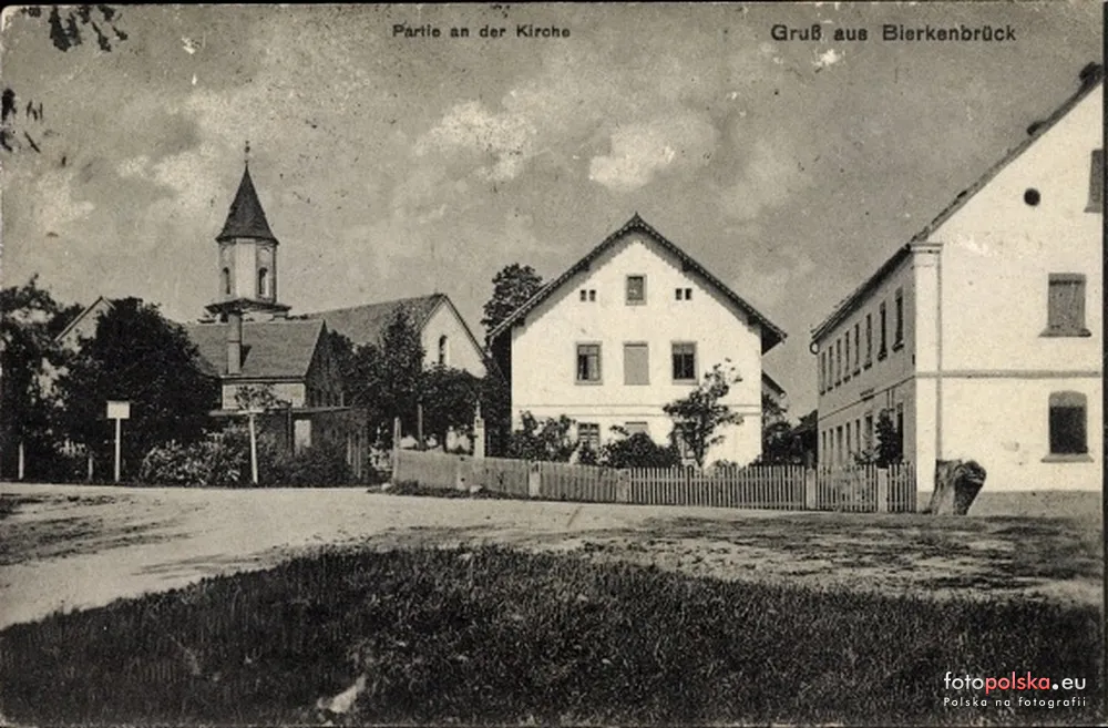
then: 1930 · fotopolska.eu · now: 2012 · fotopolska.eu
Church from 1829-1832 on the site of a temple mentioned in 1376; until 1945 under the patronage of St. George, today under the patronage of the Immaculate Heart of Mary. Next to it is a cemetery, a statue of St. John Nepomuk, and a cross of the Holy Passion.
-
4
School and former court inn
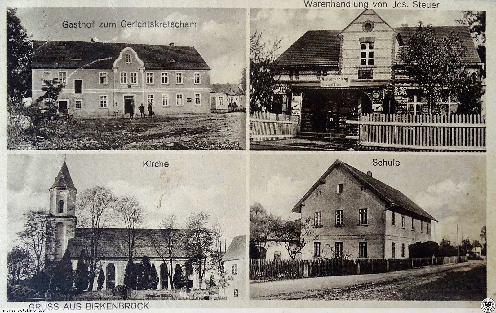
then · 1925 · polska-org.pl — have a photo of this place today? School tradition in Brzeźnik dates back to 1612. On a postcard from 1925, next to each other: a court tavern, a store, a church, and a school. Today, there is a School and Kindergarten Complex with Orlik pitches.
-
5
Volunteer Fire Department hall
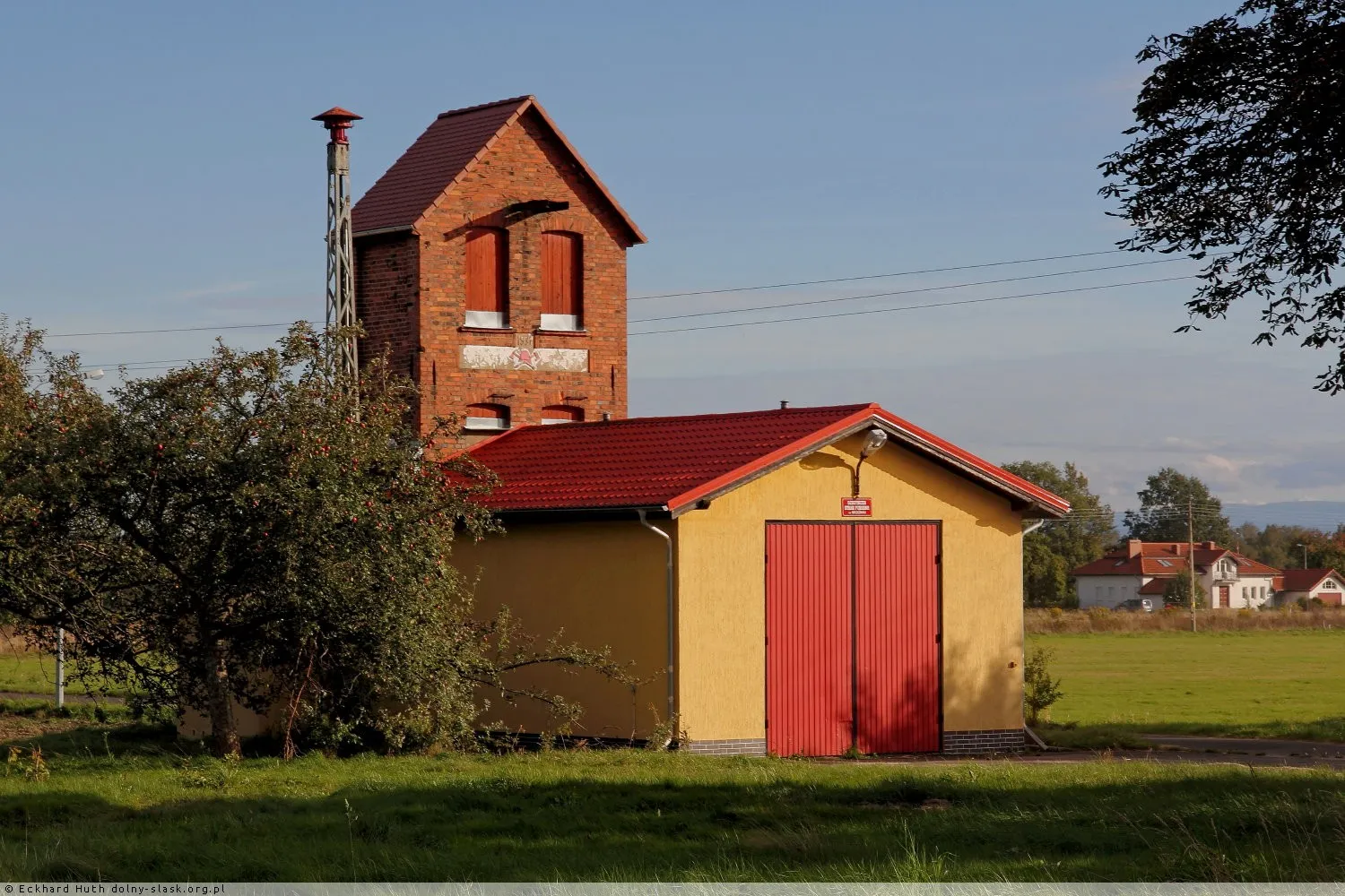
now · 2013 · polska-org.pl — have an old photo of this place? OSP fire station in the center of the village, near the church.
-
6
Ruins of the Herschelswaldau manor
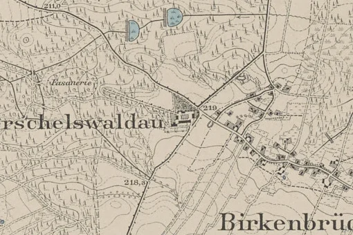
then · 1888 · mapywig.org — have a photo of this place today? Manor from the 1840s, the economic center of the village with a mine and a brickyard. Today, in the forest, there are foundations of a barn and stables, a round cellar of a manor house, holes after silos, a gate post, and a collapsed shaft of a lignite mine.
-
7
Brickyard near Herschelswaldau and tramway embankment
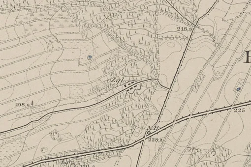
then · 1888 · mapywig.org — have a photo of this place today? The chimney still stands; under the ground, there were channels for the kiln. An embankment of the narrow-gauge railway led clay and bricks to the siding on the Wrocław-Zgorzelec line.
-
8
Monument in front of the former RAD camp
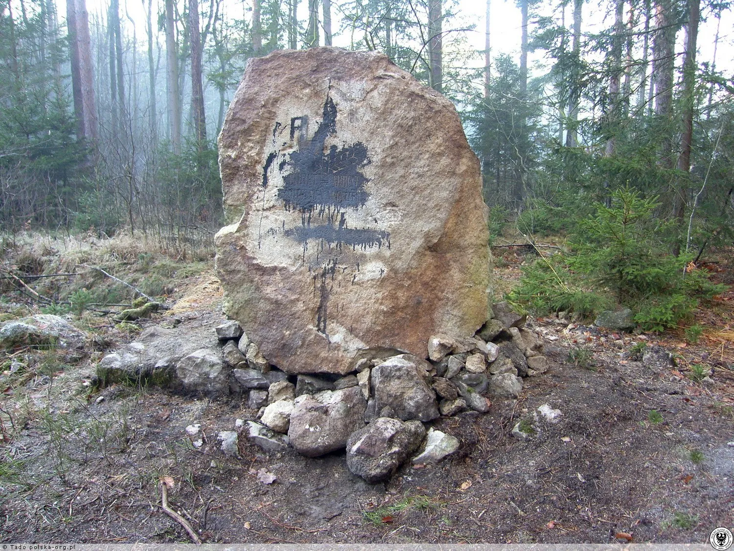
now · 2024 · polska-org.pl — have an old photo of this place? Quartzite boulder with the inscription 'Ehret die Arbeit und achtet den Arbeiter' from in front of the Reich Labour Service camp (1934), about 1 km west of the village. In 2024, the Historians' Circle from Bolesławiec re-erected it.
-
9
Forest chapel - legend of a child and wolves
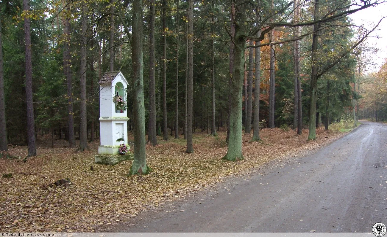
now · 2014 · polska-org.pl — have an old photo of this place? Pillar chapel on the forest road to Kierżno, associated with the legend of a child saved by wolves.
-
10
Faustmann Stone (1921)
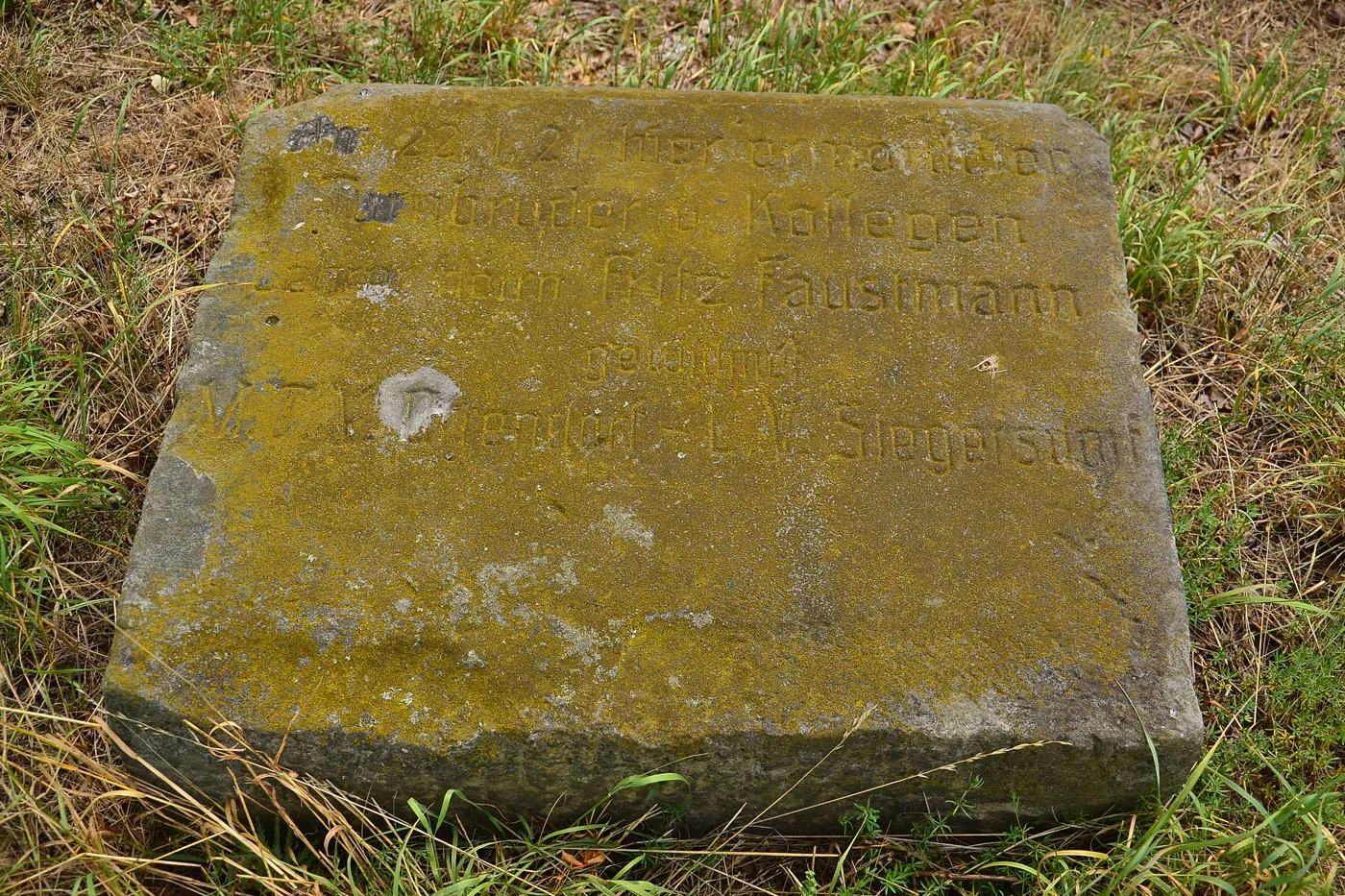
now · 2016 · polska-org.pl — have an old photo of this place? Memorial stone for the teacher Fritz Faustmann from Ocice, shot here on January 22, 1921; erected by teachers and the gymnastics society from Ocice and Zebrzydowa.
-
11
Rimpelsberg brickyard and Turquoise Pond
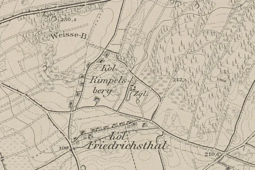
then · 1888 · mapywig.org — have a photo of this place today? Second brickyard near the Rimpelsberg colony (founded in 1712 by the prioress of the Magdalen sisters). Its chimney is visible when traveling towards Zebrzydowa, and the flooded clay pit is now called the Turquoise Pond.
-
12
Former shooting range — bullet stop
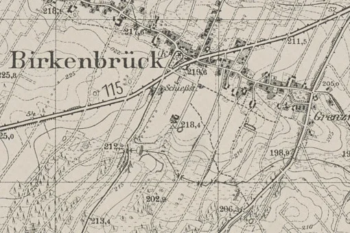
then · 1939 · mapywig.org — have a photo of this place today? A pre-war sports shooting range — marked “Schießst.” (Schießstand) on the 1939 map, south of the church, beyond the present-day DK94; it does not yet appear on the 1888 map. The concrete casing of the bullet stop still stands today. The location is approximate — if you know exactly where it is, mark it on the map using the form.
Do you have a photo of one of these places?
Most valuable are old photographs and postcards, and new photos taken from the same spot as the old ones — that is how a “then and now” comparison is made. Choose a stop on the trail or describe a new place.
Phone photos usually store their location — we will read it. You can also press “Use my location” while standing at the shrine or where you took the photo.